What is there to see in Aruba once you leave the beach?
Almost everything a visitor books in Aruba sits on one side of the island: the calm leeward coast, where the sand is, where the towns are, and where YOO Aruba is being built in Ponton. Almost everything there is to see sits on the other side, or in the dry interior between the two. This page is the island-wide answer an owner ends up giving guests over and over — which coast can be swum and which cannot, what is inside Arikok National Park, why one wind decides both, and how the island's high and low seasons appear in the numbers the developer's rental analysis is built on.
What is there to see in Aruba beyond the beaches?
Aruba is small and arid, and it is not a rainforest island. What it has instead of jungle is limestone, cactus, boulder fields and a coastline that changes character completely depending on which side of it you are standing on. The beaches everyone photographs — the long white leeward strands — are one narrow band on the south-west. Behind and beyond them the island turns dry and rocky, and that is where most of what a guest will later describe as seeing Aruba actually is: a national park on the windward side, caves carrying indigenous rock drawings, a hilltop pilgrimage chapel, the stone shell of an old gold mill, a lighthouse at the northern tip, and two towns that could hardly be less alike.
For an owner this matters more than it does for a hotel guest. Someone who never leaves the resort strip sees one Aruba. Someone who owns here is asked, on more or less every stay, what to do on the day the beach is not the plan — and the answer is a large part of what makes a residence pleasant to live in, lend or let. It is also free to know, which is more than can be said for most of what improves a rental.
Two coasts, one constant wind
Aruba sits in the belt of the easterly trade winds, and they blow across it almost without pause. That single fact arranges the whole island. The leeward south-west coast lies in the island's own wind shadow: the water is calm and shallow, the sand is wide, and this is where the towns, the hotel strip and YOO Aruba's plots at Kukwisa in Ponton all sit. The windward north and east coast takes the wind and the swell head-on — limestone cliffs, small coves cut into them, heavy surf and rip currents. It is not a swimming coast, and a guest is far better told that in advance than left to discover it.
The same wind bends the island's divi-divi trees permanently toward the south-west, which makes them the most reliable compass on Aruba. From the building, the leeward side is close in every direction: downtown Oranjestad is a 5-minute drive and about 1.3 miles, Eagle Beach 6 minutes and about 2 miles, Queen Beatrix International Airport 10 minutes and about 2.9 miles, and the Palm Beach hotel strip 12 minutes, roughly 2.7 miles in a straight line. The windward side, by contrast, is a deliberate outing rather than an errand — which is exactly why it is worth planning properly.
Arikok National Park, the caves and the natural pool
Aruba's tourism authority describes Arikok National Park as covering about a fifth of the island, and it occupies the windward side: dry forest and limestone hills, cactus, caves carrying indigenous rock drawings, and a run of coves — Boca Prins and Dos Playa among them — where the surf comes in hard enough to be worth respecting. There is an entrance pass, and the rangers post advisories that reward reading rather than skimming.
The one place inside the park that guests ask for by name is the Conchi natural pool on the north-east coast, a rock-walled pool that the sea refills over its rim. Aruba's tourism authority is explicit about how it is reached: by four-wheel drive, on horseback or on foot, with an ordinary rental car unable to continue past the park checkpoints, and with swimming safe only when the sea is calm. An owner who says all of that before a guest arrives saves them a wasted morning. An owner who does not gets the same message delivered, less kindly, by the car rental desk.
Two towns: Oranjestad and San Nicolas
Oranjestad is the capital and the cruise port, and it is the nearer of the two — 5 minutes and about 1.3 miles from the building. Its centre is Dutch-colonial in colour and in scale, walkable end to end, and served by a free streetcar that loops from the cruise terminal along the pedestrianised main street, past the old fort and the parliament. For a guest with an afternoon and no car, it is the easiest thing on the island to do well.
San Nicolas, at the far end, is the second town and the opposite in temperament. Once the island's refinery town, it has become its street-art quarter: whole building facades painted by visiting artists, a long-standing bar hung floor to ceiling with what its customers have left behind, and Baby Beach nearby, a shallow, sheltered bay at the island's south-eastern tip. Aruba's Carnival began in San Nicolas, and the town still keeps the more local version of it. Between the two towns there is a full day out, and no beach in it at all.
How Aruba's seasons show up in an owner's numbers
The island's visitor year is not flat, and the developer's rental analysis for YOO Aruba, dated 12 August 2026, models the shape of it plainly: a 360-day operating year, split into 150 high-season days at 75% occupancy and 210 low-season days at 52%, which blends to 61.6% — about 222 booked nights. On those inputs, with a platform fee of 15% and a management fee of 15%, and after HOA and utilities, it projects a net operating income of 9-16% of the purchase price depending on the residence type, before Aruban income tax, land tax, insurance and the cost of furniture. It is a projection and not a promise, and an owner's own year may not match it.
The reason the model assumes a full year at all is geographic. Aruba lies at roughly 12.5 degrees north, outside the main Atlantic hurricane belt, so there is no season the island writes off. Outside the belt is not the same as untouched — systems passing to the north have brought swell and rain — and that distinction is worth keeping, because it is the honest version of the claim. What the wind does do, reliably and in both seasons, is keep the leeward coast usable and the windward coast rough.
What guests ask, and what this page does not publish
Two questions arrive more often than any others. The first is the flamingos: they are on a resort's private island off Oranjestad rather than on a public beach, and access runs through that resort — its own guests first, with a limited number of day passes released when occupancy allows. Saying so early spares a guest building a day around something that may not be available. The second is whether a car is needed. For the leeward side, barely. For Arikok, the natural pool, San Nicolas or the lighthouse at the northern tip, yes — and inside the park itself, a four-wheel drive rather than a car.
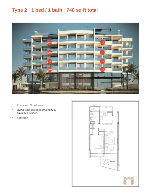
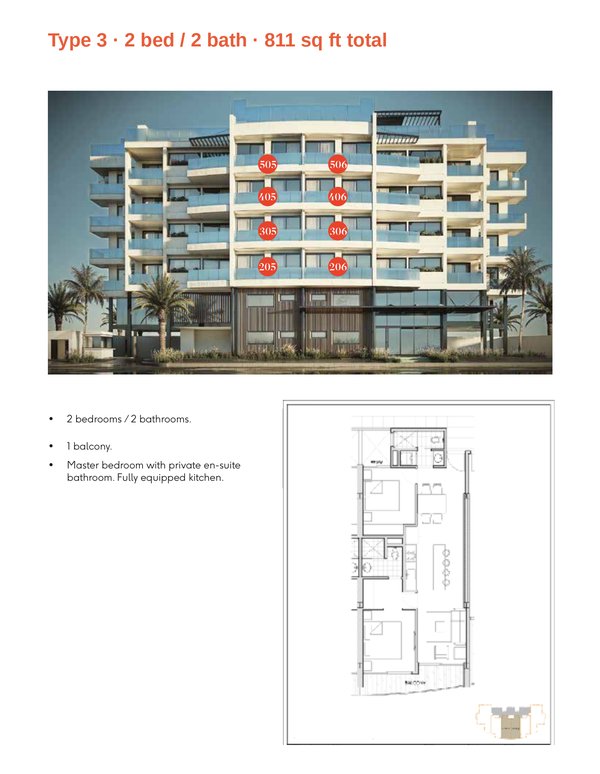
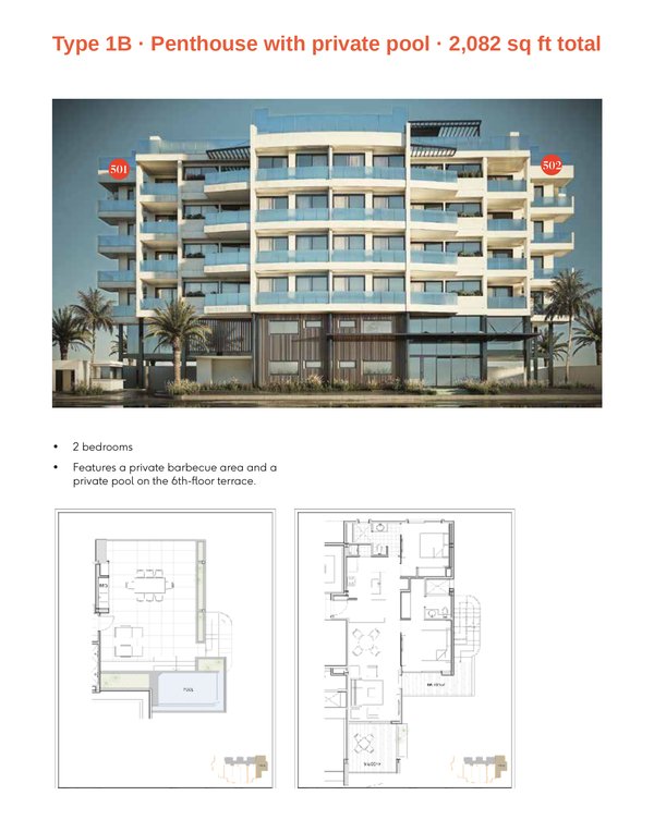
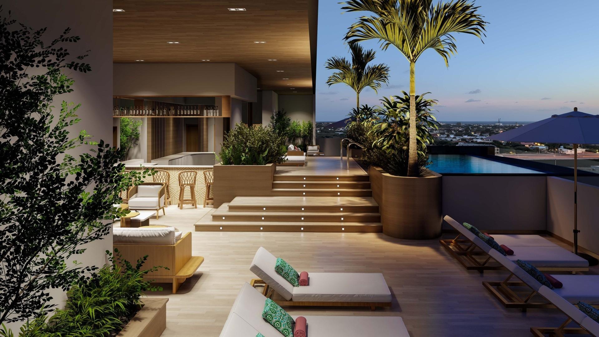
What this page will not do is print figures it cannot source. It carries no park acreage, no entrance fee, no attendance count for any single attraction and no distance from the building to the far side of the island, because none of those sit in the fact base YOO Aruba writes from; the figures here are the ones that do — the drive times, the developer's rental model and the island's latitude. The building itself is 26 residences on five residential floors, sharing a rooftop pool and sun deck, a gym, a sauna and cold plunge, a yoga room, a private massage room and a lobby bar, with a 24-hour concierge, priced in US dollars from $443,000, and delivery committed for Q4 2027 as an estimate subject to force majeure.
Common questions
- Can you swim on Aruba's north coast?
- Not safely. The north and east coast is the windward side: limestone cliffs, heavy surf and rip currents, with coves that are for looking at rather than swimming in. Swimming happens on the calm leeward south-west coast, where Eagle Beach is 6 minutes and about 2 miles from YOO Aruba.
- How do you get to the Conchi natural pool?
- By four-wheel drive, on horseback or on foot, inside Arikok National Park on the north-east coast. An ordinary rental car cannot continue past the park checkpoints, an entrance pass is required, and Aruba's tourism authority says to swim only when the sea is calm.
- Is there a time of year to avoid in Aruba?
- Aruba lies at roughly 12.5 degrees north, outside the main Atlantic hurricane belt, and the developer's rental analysis assumes a 360-day operating year rather than closing a season — 150 high-season days at 75% occupancy and 210 low-season days at 52%. Outside the belt is not untouched: systems passing north of the island have brought swell and rain.
Want the details for your own situation?
Ask about availability, layouts or the buying process, and someone from the sales team will get back to you.
Get in touch